Jdinar Geomatics Sdn Bhd is formerly known as Jurukur Dinar. Jdinar Geomatics Sdn Bhd is a Registered Land Surveyor company Malaysia established under the Licensed Land Surveyors Act 1958(Act 458) (Revised in 1991). Our company was founded by Sr. Shah Nizam Bin Basirun, MRISM, MAALS at 1st April 2011.
Our Vision
A vision to provide services in professional surveying and mapping in worldwide.
Our Mission
To deliver information on people about land survey and to provide solution for client.
Core Values.
Respectful
Always consider the needs of customers and colleagues and behave in a courteous manner.
Integrity
Always do the right thing in a professional manner.
Trustworthy
Build trust with customers through regular contact and a prompt response to all enquiries.
Nurturing
By continually investing in training and people, our team are encouraged to maximise their potential
Technology
Keep up to date with the latest developments in survey technology and continually improve our services.
Open & Honest
Always be honest and truthful with customers and colleagues. Be open with our customers and deliver what we promise.
Jdinar Geomatics is a highly experienced team of land surveyors.
Our Expertise for Your Problem
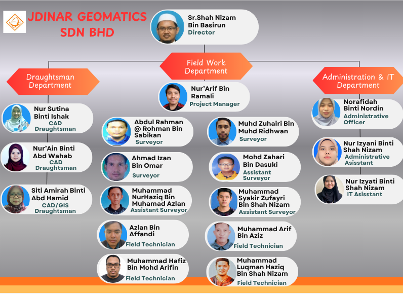
Meet Our Team
Organization Chart
Tingkat 1 PS 1009, Taman Cahaya Pulau Sebang, 78000 Alor Gajah, Melaka